Edit chart
Loading graph
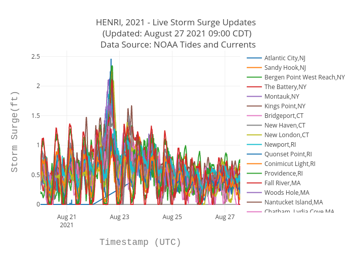
Srcc2020's interactive graph and data of "HENRI, 2021 - Live Storm Surge Updates (Updated: August 27 2021 09:00 CDT) Data Source: NOAA Tides and Currents" is a scatter chart, showing Atlantic City,NJ, Sandy Hook,NJ, Bergen Point West Reach,NY, The Battery,NY, Montauk,NY, Kings Point,NY, Bridgeport,CT, New Haven,CT, New London,CT, Newport,RI, Quonset Point,RI, Conimicut Light,RI, Providence,RI, Fall River,MA, Woods Hole,MA, Nantucket Island,MA, Chatham, Lydia Cove,MA, Boston,MA, Seavey Island,ME, Wells,ME, Portland,ME, Bar Harbor,ME, Cutler Farris Wharf,ME, Eastport,ME; with Timestamp (UTC) in the x-axis and Storm Surge(ft) in the y-axis.. The x-axis shows values from 0 to 0. The y-axis shows values from 0 to 0.