Edit chart
Loading graph
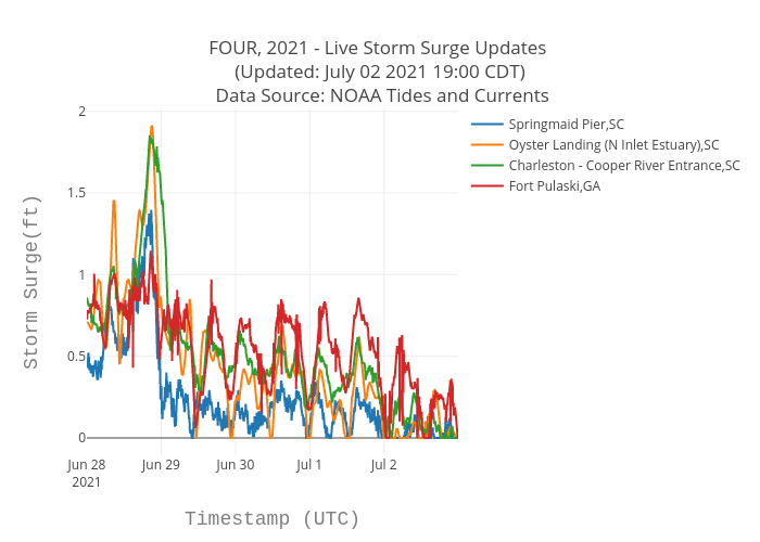
Srcc2020's interactive graph and data of "FOUR, 2021 - Live Storm Surge Updates (Updated: July 02 2021 19:00 CDT) Data Source: NOAA Tides and Currents" is a scatter chart, showing Springmaid Pier,SC, Oyster Landing (N Inlet Estuary),SC, Charleston - Cooper River Entrance,SC, Fort Pulaski,GA; with Timestamp (UTC) in the x-axis and Storm Surge(ft) in the y-axis.. The x-axis shows values from 0 to 0. The y-axis shows values from 0 to 0.